Wednesday 27 November 1918 – Joyriding

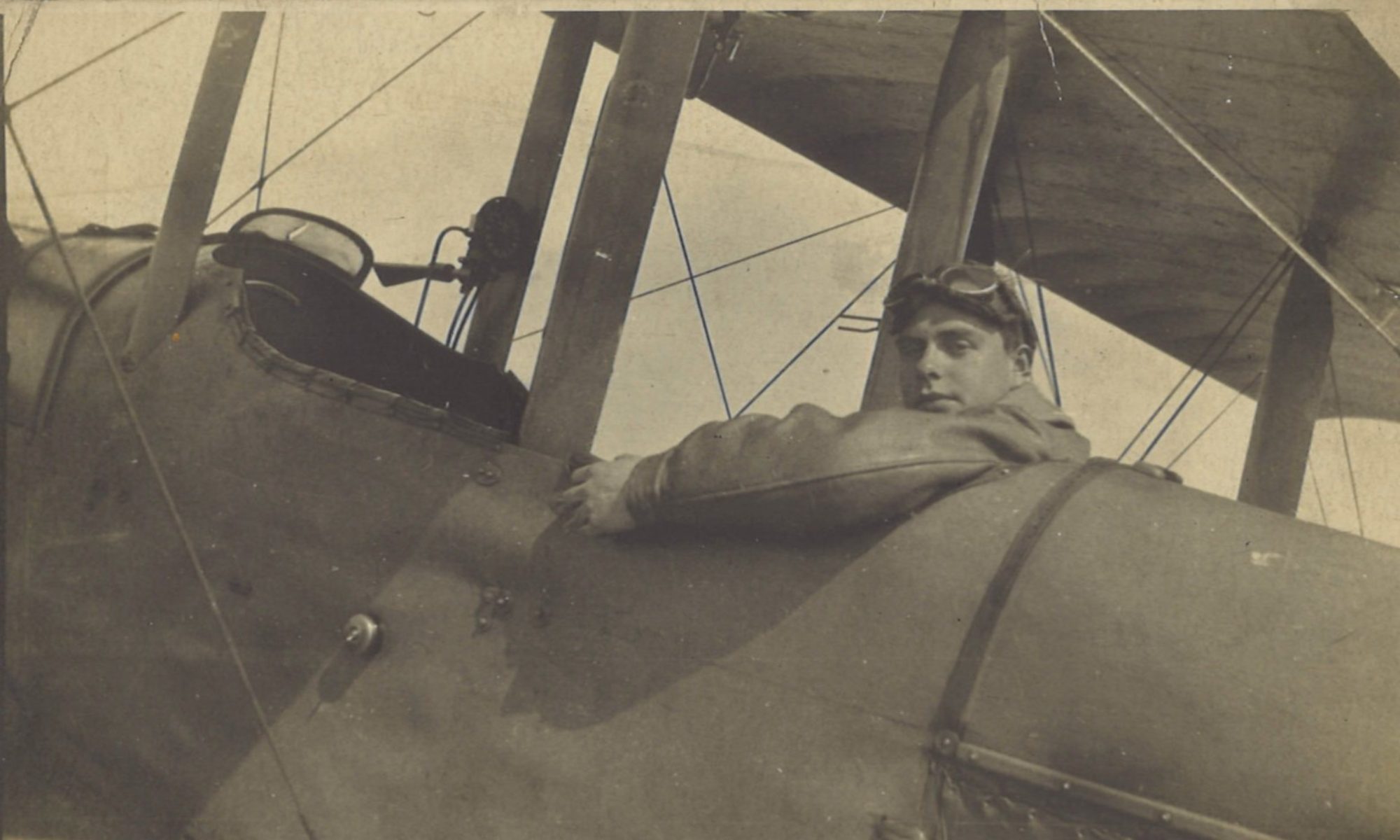
Although Greg’s log book doesn’t record any joyriding flights after the armistice, it is hard to believe that he didn’t take any.  Actually, joyrides were officially sanctioned, no doubt because it was important for airmen to keep their flying skills in trim.  They had to police the armistice, and to be ready for any resumption of hostilities.  After all, an armistice was not a peace treaty. 

Joyriding Orders

Despite the absence of log book entries, we do have a couple of undated pages of the B Flight Orders book to work with.  One of them contains official orders on joyriding.  The other – more on which below – is distinctly unofficial. From its position between two dated pages, we can pin the page of official orders down to sometime between 11 November and 2 December.    All other things being equal, it is more likely than not that the orders were in force by today.

B Flight Orders - Joyriding

Joyriding—

Two machines per flight are allowed to joyride every day. 
They may go anywhere within reason, provided that —
1. They land on an aerodrome.
2. They return to the Squadron before dusk.  Anyone staying out overnight will be severely dealt with. 
N.B.  Marquise & places at that distance are not within reason. 

                         C. E. Gregory, Lt.
                         for O.C. B Flight

“Marquise & Places at that Distance”

Marquise is near the coast, between Boulogne and Calais.  It was by this stage where No. 1 ASD was based (see the post for 3 June 1918).  We don’t know whether this page in the B Flight Orders book was written before or after the move from Marquain to Aulnoy on 25 November 1918.  But in either event, Marquise was at some distance:  72 miles (116 km) from Marquain and 86 miles (138 km) from Aulnoy. 

Presumably flying east over the armistice line was verboten.  But even so, when flying west there were still plenty of places to choose from.  Although day trips to the seaside were clearly out, the following places may well have been considered ‘within reason’.  

  • Rely (54 miles, 87 km from Aulnoy)
  • Aire-sur-la-Lys (54 miles, 87 km)
  • Villers-Bretonneux (54 miles, 87 km)
  • Trèzennes (52 miles, 84 km)
  • Ypres (45 miles, 73 km)
  • Merville (44 miles, 71 km)
  • Chocques (44 miles, 71 km)
  • Lille (29 miles, 47 km)
  • Ascq (25 miles, 41 km)

Additionally, a good deal of what for much of the war had been the British and German front lines – as well as no-man’s land in between them – would have been within 30-60 miles (50-100 km) of Aulnoy.

Several of the photographs in Greg’s collection were undated, and may have resulted from joyrides in this post-armistice period.  Some have already been published in the blog, on significant days for the locations concerned or for 42 Squadron.  They include:

Villers-Bretonneux 

(What look like freshly dug trenches in the oblique aerial view of this post suggest an earlier date than after the armistice.  But the undated photograph is included here for completeness.)

Thursday 25 April 1918 – N’oublions jamais l’Australie

Casualty Clearing Station, possibly the 54th CCS at Aire

Sunday 23 June 1918 – Feeling Groggy, Crash at Rely

Ypres

Saturday 28 September 1918 – Ypres

Lille

Thursday 17 October 1918 – Flying East of Liberated Lille

Other undated aerial photographs in the collection will be posted in the coming days and weeks.

The Unofficial Joyriding Rules

A little later – probably after 3 December 1918 – a page of unofficial joyriding rules appeared in Greg’s B Flight Orders book.  Despite its probable later date, this seems the best time to release it.

B Flight Orders - the unofficial joyriding rules

                 Joy Riding

Officers are forbidden:-

(1) To take ‘bints’ in the buses.
(2) Drop bombs on the Officers’ Mess.
(3) Nose dive at less than 100 feet.
(4) Make ascents in bathing costumes.
(5) Take more than 3 bottles of whisky at once into the air.
(6) Return to aerodrome without observer.
(7) Drop empty bottles near GHQ.

Unlike the other entries  in the B Flight Orders book, this doesn’t seem to be a carbon copy.  So it’s unlikely that anyone posted a top copy onto a notice board.  It’s even less likely that this list was compiled without a liberal quantity of alcoholic inspiration!
Saturday 28 September 1918 – Ypres

Today was the beginning of the Advance in Flanders, also known as the Battle of the Peaks of Flanders, or the Fifth Battle of Ypres. Ypres – Ieper to its inhibitants – was out of Greg’s sector, but somehow a couple of remarkable aerial photographs of that poor, shattered city came into his hands.  Precisely when they were taken, and by whom, isn’t known for certain as they are unmarked.  But quite possibly they were taken by Greg when joyriding after the Armistice.  We are publishing them today to mark ‘Fifth Ypres’.

Ypres and its Canals

The centre of Ypres is bounded by canals. The widest ones are the Majoorgracht to the west, and the Kasteelgracht to the east.  They both arc round to the south of the city centre, where they meet.  It is over the Kasteelgracht that the bridge by the Menenpoort (Menin Gate) leads notheast towards Zonnebeke and Passendale, better known to English speakers by its archaic French name of Passchendaele.  To the north, the Hoge Weiltjesgracht folds under the Ieperlee, the north-flowing canalised river that drains the land towards the North Sea.


Google Maps satellite view of Ypres/Ieper

Majoorgracht and Pacific Eiland

Near the northwestern end of the Majoorgracht is an island: Pacific Eiland.  It is now the home of an inviting restaurant of the same name, whose website explains:

Around 1640 this island was built by the Spanish occupiers to deter the enemy and as ammunition depot. Now it has been transformed into a haven of peace and relaxation where young and old are welcome.

 It is indeed now a haven of peace.  But in 1918 it was anything but:

Vertical aerial view of Majoorgracht and Pacific Eiland
Vertical aerial view of Majoorgracht and Pacific Eiland. Click for larger view. Image credit: Gregs War Collection

Here is equivalent view on Google Maps today: 

Present day Google maps view of Majoorgracht and Pacific Eiland
Present day Google maps view of Majoorgracht and Pacific Eiland. Click for larger view

And the view south from Pacific Eiland over the Majoorgracht:

“A haven of peace and relaxation” says the website of the Pacific Eiland restaurant. Today, looking south from the island over the Majoorgracht, it is hard to disagree with that.  Research isn’t always arduous. Click for larger view.  

Ypres Prison, Ypres Reservoir Cemetery and Minneplein

A second Ypres photograph in Greg’s collection takes in the northwestern part of the city centre.  To put it in context, here is a Google Maps satellite view of Ypres, with the field of the photograph edged in white.  The arrow shows the edge that will be at the bottom:

Google Maps satellite view of Ypres.
Google Maps satellite view of Ypres, with the field of the following photograph outlined. Arrow shows bottom of field.

With that overview in mind, here now is the view in 1918 of the white-edged portion…

Vertical aerial view of Ypres Prison, Reservoir Cemetery and Minneplein
Vertical aerial view of Ypres Prison, Reservoir Cemetery and Minneplein, 1918

…and the equivalent view today from Google Maps:

Present day Google maps view of Ypres Prison and Minneplein
Present day Google maps view of Ypres Prison, Reservoir Cemetery and Minneplein. Click for larger view

Ypres prison – Gevangenis Ieper – is towards the top of the photo, on the right of the centre.  In 1918 it was a wrecked building, but the internal panopticon structure beloved by architects of prisons and libraries is clearly visible.  The green area in the top right corner is Ypres Reservoir Cemetery, containing 1,579 First World War graves.  A school – Campus Minneplein – now occupies part of the open square of Minneplein, on the middle right and bottom right corner.  Normal life in Ieper – the city of the elms.


Monday 3 June 1918 – Arrived at 42 Sqn at Rely

After his long journey and spending the night in a railway truck in Aire-sur-la-Lys, Greg finally made it in the morning to his squadron – No. 42 Squadron RAF, Major H. J. F. Hunter, M.C., commanding – at Rely Aerodrome.  He had a first, short flight with the squadron that afternoon.

Diary

Diary
Diary
Monday June 3rd 1918.  Phoned up to 42 Squadron for tender.

Managed to find an Hotel with someone in, where we had breakfast.

Arrived Squadron (at Rely, nr Estrée Blanche, west of Merville) about 9.30am.  Posted to B flight. (Merville – midway between Ypres & Arras.)

[Side note] Squadron about midway between Ypres & Arras.  Front includes Eastern edge of Forest of Nieppe & down to where the line cuts the La Bassée canal north of Béthune.

Log Book

Log book
Log book
Date: 3.6.18 
Hour: 1.30 
Machine type: RE8 
No.: - 
Passenger: Sandbag flight 
Time: 10 min 
Height: 1500 
Course: Aerodrome 
Remarks: Good landing

Rely Aerodrome

So began Greg’s time at Rely, where he was to spend several months.  Rely is a small village set amongst farmland on the gently rising ground to the west and south of the Lys.  It is about 31 miles (50 km) WSW of Lille.  If the name seems familiar to British travellers to France today, it is probably because the Aire de Rely is the first eastbound service area on the A26 autoroute (L’Autoroute des Anglais) from Calais.  

Rely, Merville and Lille map
Rely, Merville and Lille on a modern map (courtesy Google). Click for a larger, zoomable map (opens in new tab).

The First World War aerodrome at Rely was at 50°34’44” N 2°21’4″E (hat-tip to Anciens Aerodromes) , which places it on the Rue de Liettres, NW of the village centre just on the 100 m contour line.  The site looks like this in Google Street View today:

 RE8 E102

As it happens, today was the day that the Squadron’s daily orders recorded that the RE8 aircraft with the serial number E102, which was to be allocated to Greg the following day, was officially transferred to the strength of the squadron:

Daily orders for 3 June 1918

E102 had come from No 1 Aero Supply Depot.  Following the Spring Offensives on 15th April No 1 ASD and its repair section moved from St Omer to Marquise, 8 miles (13 km) NE of Boulogne – http://1914-1918.invisionzone.com/forums/topic/121124-northern-area-repair-depot/.

The Front Line

The sector of the front line on which 42 Sqn was working ran, as Greg notes, from the east of the Nieppe Forest (just west of Merville) to the La Bassée canal near Béthune:

Front Line near Merville map
The Front Line near Merville, from Gen. Haig’s despatches. Image credit: IWM/GreatWarDigital

Most of the action that Greg saw would be in the north of this sector, near Merville.

Sandbag Flight

As Greg had no observer or passenger with him on his first short flight, he had to carry sandbags to ensure that the aeroplane was properly balanced, as explained here, under the heading “Crew”:

The Royal Aircraft Factory RE8

So now he was ready for whatever the next day would bring.


Header image: site of First World War Rely Airfield, from Google Street View.

© Copyright 2018- Andrew Sheard and licensors. All rights reserved.