Friday 1 November 1918 – Shoot with Capt. Gordon

In what would turn out to be Greg’s last successful shoot of the war, Capt. Cedric Foskett Gordon was Greg’s observer for the first time today.  Captain Gordon was one of the senior officers of B Flight, 42 Squadron and was evidently a remarkable character.

Log Book

Log Book

Date: 1.11.18 
Time Out: 13.15 
Rounds Fired – Lewis: - 
Rounds Fired – Vickers: - 
Bombs: - 
Time on RE8s:  185 hrs 10 mins 
RE8: 2407 
Observer: Cpt. Gordon 
War Flying: 2 hrs 15 mins 
Height: 7000 
Course/Remarks:  Shoot Portuguese. Successful.

“Shoot Portuguese” 

This is nothing to do with shooting Britain’s Portuguese allies, of course.  Rather, it is everything to do with observing a shoot involving Portuguese artillery. 

For reasons explained in yesterday’s post, no Squadron Record Book entry is available for today:

Counter Battery Patrols and Zone Calls

Because of that, we don’t know much about the shoot.  The battery, though, was evidently one of the few remaining Portuguese artillery units.  The Portuguese Expeditionary Corps had suffered badly on the first day of the Battle of the Lys, on 9 April 1918.  As a result of this, by the end of the war Portugal had only nine artillery pieces left, according to the Passion and Compassion 1914-1918 website.  Two of them were heavy howitzers: a British 6″ siege piece, and a similarly sized Franco-Portuguese  15 cm T.R. Schneider-Canet-du-Bocage.  Given that Greg’s shoots tended to be with heavy (siege) artillery batteries, it was possibly that it was with these howitzers that he was observing and directing artillery fire today.

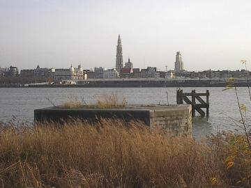
What might the target have been?  We don’t know.  Maybe it was one of the usual suspects: a hostile battery (Greg’s most frequent target), an ammunition dump, trenches, or a strategically important crossroads.  Or it might have been something unusual, thrown up by the unprecedented circumstances in these last, heady days of the war.  In any event, the target must have been east of the River Scheldt/Escaut, along which the British front line still ran in Greg’s sector. Some miles both to the north and and to the south of Tournai, though, further eastward progress had been made:

Map of the British Front on the morning of 1 November 1918.
The British Front on the morning of 1 November 1918. Adapted from a map accompanying General Haig’s despatches on the final British offensive. Click for larger image. Map credit: IWM/TNA/Great War Digital.

Captain Cedric Foskett Gordon MC, CdG

Greg’s observer today was Captain Gordon.  Capt. Gordon was one of the two commanding officers of B Flight of 42 Squadron. He was evidently quite a character.

The following brief distillate of Capt. Gordon’s life comes, with permission, from Matt Ball’s informative Sevenoaks WW1 blog (see main link below or here):

Early Life and Wartime

Cedric Gordon was educated at Lancing College, were he excelled in sports. In 1910, he was commissioned into the North Staffordshire Regiment. He was sent to France on the outbreak of war and was wounded twice. In 1915 he was awarded the Military Cross for leading an attack on a village.  

His second injury was the most serious and resulted in his losing a leg. You might be forgiven for thinking that this would be the end of his war service but Cedric joined the Royal Flying Corps and continued his wartime service as an observer and air gunner on the Western Front. He was subsequently awarded the Croix de Guerre in 1917, was mentioned in dispatches four times and awarded the military class of the OBE in 1919.

According to a nephew,  quoted in his obituary, Cedric was shot at during one flight with the bullet shattering his wooden leg. On landing, he was said to have found the stray bullet in his pocket and was confined to bed until the camp carpenter had made him a new leg.

Post War

After the war, and having gained his pilot’s licence despite his wooden leg, Cedric was sent to Russia with British forces to aid the White Russians in the Crimea in their fight against the Bolsheviks. He was awarded the Distinguished Flying Cross and received the Order of St Ann and the Order of St Stanislas from the Russians. After leaving Russia, he flew in Palestine, where during one flight for reconnaissance work, he was forced to land in the desert and was, according to his obituary ‘picked up by a band of friendly Arabs’.

Cedric later worked for British intelligence in mainland China, before returning to England and taking command of the RAF Bloom Centre. During the Second World War, he was eventually put in charge of the South East Air Training Corps and was also a member of the Home Guard.

Retirement

On his retirement, he returned to Lancing College, where his brother Edward was a Master, to become Bursar. Later in life he became well known in Sevenoaks for his involvement in the local scouting movement.

The above comes from this post:

No doubt it was Capt. Gordon’s unusual circumstances that meant he was one of two officers in B Flight to hold the rank of Captain.  The other was Capt. Bill Ledlie (of whom more here). 

First Day Back

As it turns out, 1 November 1918 was Capt. Gordon’s first day back at the squadron at Ascq. For part of October he had been on leave in the UK. When he returned, he found that his dog (who rejoiced in the name of Waso) was missing.  His own account of the day and the latter part of his journey back is preserved in a letter to his mother.  This letter is one of a number kindly made available by Cedric Gordon’s nephew, Keith Gordon.  As Matt Ball notes in another post on the Sevenoaks WW1 blog (see below, but also linked here):

What emerges from these letters is a strong sense of a close, spirited family, each with at least one nickname (Cedric’s was ‘beast’ owing to his general strength), and a spirit of adventure embodied by Cedric himself. No doubt some of his insouciance is designed to reassure his worried mother, to whom all of these letters are addressed… 

With that as background, here is the text of Cedric Gordon’s letter of 1 November 1918:

All Saints Day (1 November) letter to darlingest Mother from 42 Squadron, RAF, BEF  

I have arrived at last.  

To go on where I left off.  O’Keefe & I went & lunched at an estaminet where we had an excellent fish, some veal & a bottle of red wine, all of which made me far more contented with the world at large.   This done, we returned to our vigil at the Town Mayor’s office & at about 3pm our Tender finally arrived.   After a long & uneventful journey we arrived at the Squadron about 7pm.  

Waso was reported missing, believed to have been stolen by a general belonging to the Corps.   This was rather depressing, but the major who commanded 42 Sqn promised to take me round to the Corps with a view to returning my hound.   I had dinner with HQ Mess & then went round to my Flight Mess (B Flight) & found them full of good cheer & beer.   We had quite an amusing evening.   I have got a very nice billet.   There are quite a number (at present unknown) of French people living here.   They have provided me with a very nice room upstairs & a large bed, sheets etc & a very small basin!   The natives speak very bad French & I can’t make a great deal of headway with them, however they are very friendly.  

This morning…

…I rose about 7.30am & sorted out my hut, such of it as hasn’t been lost during my absence.   I spent the morning playing about with a Lewis gun & this afternoon I went up for a short time.   This is an extraordinary safe job & no one gets hurt at it.   So don’t you worry, dear old bird.  

This evening…

…I went down with Hunter (the OC) to the Corps to interview this General man who had acquired Waso.   I looked through the glass door & saw old Waz inside, so softly I opened the door & Waso came bounding out.   She was awfully pleased to see me, almost as pleased as I was to see her.   After a bit I got hold of the General who was a very nice fellow.   He said he found her many miles away & had adopted her.   I expect someone had picked her up in a lorry or some vehicle & dropped her off after a bit.  

He was very loath to part with her & said he was very fond of her, which is not surprising.   However, he gave her up & I promised him a puppy when the next instalment arrives, & we parted friends.   Normally people go to bed here about 8.30pm, which is rather dull.   They are, on the whole, a very comic crowd, but there are several very nice fellows.  

I have missed you…

…most awfully.   It is rotten leaving you, however before very long now the war will be over & Waso & I will return to the family.   No more news at present.   Very fondest love darlingest.   Best love to Karf who, together with my old Mother, made my leave absolutely splendid.   I hope Am is well.   God bless you darlingest.

Photos

Greg had a few photos of Capt. Gordon in his collection.  The two of them must have been in touch after the war, as that is evidently when at least a couple of the photos were taken. I’m grateful to Keith Gordon for his help with identifying the locations of the last two.

Captain Cedric Foskett Gordon
Captain Cedric Foskett Gordon. Credit: Greg’s War Collection. Click for larger image.
Captain Cedric Foskett Gordon
Captain Cedric Foskett Gordon. Credit: Greg’s War Collection. Click for larger image.
Captain Cedric Foskett Gordon
Captain Cedric Foskett Gordon. This was a post-war photograph from the time he was a member of the Mission to South Russia (1919 – 1920). Credit: Greg’s War Collection. Click for larger image.
Captain Cedric Foskett Gordon
Captain Cedric Foskett Gordon. This was a post-war photograph, taken during his return to UK from South Russia. Credit: Greg’s War Collection. Click for larger image.

A Telling Tale

To get a further flavour of Cedric Gordon’s character, here is a link to Matt Ball’s second post on Cedric Gordon, which contains the text of several more letters.  The last of the letters, dated 24 September, is worth reading in particular. It is about a scouting excursion on the ground beyond the lines.


Wednesday 23 October 1918 – Front Reaches River Scheldt

By the morning of Wednesday 23 October 1918, the British Front had reached the River Scheldt, north and south of Tournai.  The front was in the western outskirts of Tournai, but the city itself wasn’t yet in British hands.

Map showing that the British Front had reached the River Scheldt by the morning of 23 October 1918
The British Front had reached the River Scheldt by the morning of 23 October 1918. Adapted from a map accompanying General Haig’s despatches on the final British offensive. Click for larger image. Map credit: IWM/TNA/Great War Digital.

In the six days since 17 October 1918, the front had moved east by 15 miles (24 km).  This probably represented the most rapid advance by British troops on the Lys sector.

River Scheldt

The River Scheldt (Escaut in French, Schelde in Dutch)  rises at Gouy, near Le Cateau, in the Aisne département of France and flows north through Valenciennes (France) and Tournai (Belgium) to Ghent, where it is joined by the River Lys.  Thereafter it continues north to Antwerp, whose citizens it “connects with the rest of the world”, according to a former mayor.  After Antwerp it crosses the border into the Netherlands, and flows into the North Sea at Flushing (Vlissingen).

Thursday 17 October 1918 – Flying East of Liberated Lille

Today was the day of the liberation of Lille. It was a momentous day for the populace, when the British Fifth Army under General Birdwood entered the city. It was also significant day for Greg:  he records for the first time that he was reconnoitring east of Lille, near and around the Fort du Vinage.  He noted the destructive trail left by the withdrawing German army, and he reported the newly established German line south of Roubaix.

Log Book

Log Book

Date: 17.10.18 
Time Out: 14.10 
Rounds Fired – Lewis: - 
Rounds Fired – Vickers: - 
Bombs: - 
Time on RE8s:  173 hrs 35 mins 
RE8: E27 
Observer: Scarterfield 
War Flying: 2 hrs 15 mins 
Height: 2000 
Course/Remarks:  Reconn.  5000x E of Lille

5000x E of Lille

There is a bit of a puzzle in the log book entry: what does the x denote? 

The first issue is what letter it actually is.  I have transcribed it as a superscripted ‘x’, as that seems to me to be the most likely option.  But it could, just conceivably, be a ‘t’.  But in that case, what might a ‘t’ stand for?  From the Squadron Record Book (SRB), extracted below, we can establish definitively that it doesn’t mean British troops. The entry clearly states: “No British troops seen East of Lille”.  And although German troops east of Lille would be unremarkable, the SRB merely refers to a “few odd German infantry with civilians on road…”  The same reasoning would also rule out tanks (if the quantity of 5,000 hadn’t ruled them out anyway).

But in any event, the superscript looks more like an ‘x’ than a ‘t’.  And it is hard to think of a plausible word beginning with an ‘x’ that it might stand for.  

So what else might ‘x’ mean?

Might it indicate height?  5,000 ft is certainly a reasonable height for an RE8 to fly at.  But on this occasion both the log book and the SRB tell us that Greg flew no higher than 2,000 ft.  So that’s not it.

My working hypothesis is that ‘x’ indicates distance, specifically yards, on the ground.  The maps that Greg was working with all had numbered 1,000 yard sub-squares, within 6,000 yard lettered squares.  (See the article on Counter-Battery Patrols for an explanation of how the map reference system worked.)  So pilots would be well used to gauging distances in 1,000 yard units.  Given the locations that Greg reported on in that patrol (from the SRB again), it is likely that he was flying some five map sub-squares east of Lille, which is to say 5,000 yards east of the city.  But even if this is the correct explanation, I don’t know why he wrote ‘5000x‘ and not ‘5000 yds’.  Any suggestions or alternative explanations welcome.

Squadron Record Book

Squadron Record Book

Squadron Record Book
Squadron Record Book. Click for larger image.
Type and Number: R.E.8.27
Pilot and Observer: P. Lt Gregory. O. Lt Scarterfield
Duty: Reconnaissance
Hour of Start: 1410
Hour of Return: 1625
Remarks: FIRES at the following places:-
Farm F.25.d.4.5
Houses K.6.a.4.6
Factory Q.1.b.0.4
   "    K.20.d.5.0
   "    K.15.central.)
   "    K.2.c.0.5    ) Commenced during patrol.

Enemy trench system in wood at L.22.a.&.b. apparently unoccupied; full of water.
Few odd German Infantry with civilians on road L.15.d.& L.16.a.
BRIDGE destroyed at:-
Railway over road at L.13.d.4.5.
   "     "    "      K.24.d.6.4.
   "     "    "      K.23.d.9.3.
   "     "    "      K.22.b.6.9.

All bridges and locks on Eastern water defences [see below] of LILLE destroyed.
EXPLOSIONS at:-
1534. K.5.c.6.8. (Apparently dump)
1535. F.26.a.Central.

Large fires burning in LANNOY and on Eastern outskirts of ROUBAIX.
Bridges along river from L.9 to L.29 all destroyed.
Forts BABYLON, du VINAGE, & de MONS [en BAROEUL] occupied lightly by patrols.
Fired at with rifles from FORT DU VINAGE. [see below]
1530. Two civilians at Fort roads [sic: cross-roads?] at K.18.central, proceeding from direction of ROUBAIX to LILLE.
No British troops seen East of LILLE.
Enemy outposts appear to be holding a line roughly running though L.16, R.10 & X.5.  Few odd patrols & civilians seen W. of this line.

A.A. Vigorous burst of accurate A.A. fire over L.24. & L.29 at 1525.
Vis poor.  Height 400/2000’.  Obs by P.&.O.

This lengthy Squadron Record Book entry confirms that the action was shifting to the east of the city by mid-afternoon.  Much infrastructure had visibly been destroyed by the withdrawing German army.  It was a remarkable day, given that it had started with the British front line being some 4½ miles (7 km) northwest of Lille, towards Armentières:

Map of British Front west of Lille on the morning of 17 October 1918
The British Front west of Lille on the morning of 17 October 1918. By the afternoon, the city would be liberated. Adapted from a map accompanying General Haig’s despatches on the final British offensive. Click for larger image. Map credit: IWM/TNA/GreatWarDigital

And here, on a larger scale map, are some of the locations mentioned in the SRB entry for the mid-afternoon reconnaissance patrol undertaken by Greg and Lt Scarterfield:

Map showing observations on reconnaissance patrol on 17 October 1918.
Map showing observations on reconnaissance patrol on 17 October 1918. Adapted from a 1:40,000 scale map. Each numbered square is 1,000 yards. Click for larger image. Map credit IWM/TNA/GreatWarDigital.

Fort du Vinage, and Anti-Aircraft Fire

Greg says that he was fired at with rifles from the Fort du Vinage (also known as the Fort du Haut Vinage).  He can’t have been flying too far from it to see this happening.  Fort du Vinage is about five sub-squares (5,000 yards) east of the centre of Lille. 

Also, he reports a “vigorous burst of accurate A.A. [anti-aircraft] fire over L.24. & L.29 at 1525”.  Those sub-squares are about five sub-squares east of Mons-en-Baroeul, on the easternmost outskirts of the city.

These points support the idea that the ‘5000x‘ in the log book is a reference to 5,000 yds east of Lille.

Bridges on Eastern Water Defences Destroyed

The old city of Lille was surrounded by water.  Over the last hundred years, Lille has expanded greatly.  The southern and eastern water defences of the old city have been filled in and are the course of Autoroutes that form part of the city’s boulevard périphérique.  The northern part of the old eastern water defences now also accommodates the high speed rail line from Calais and London and is the site of Lille Europe station (“Lilleurope” as they announce it on the Eurostar trains).  Both the tracks at this point and the station are underground.

Map of Lille in the First World War.
Lille in the First World War, from a 1:40,000 scale map. Each numbered square is 1,000 yards. Click for larger image. Map credit IWM/TNA/GreatWarDigital.
Map of Central Lille today.
Central Lille today, from 1:25,000 scale map re-scaled to match the First World War map above. Click for larger image. Map credit IGN France/GreatWarDigital.

The German Line

Greg records that “Enemy outposts appear to be holding a line roughly running though L.16, R.10 & X.5”.  This line runs more or less due south from Roubaix, some 4 miles (6.5km) east of the centre of Lille.  It passes through Anappes and Sainghin.  Annappes is now part of Villeneuve-d’Ascq, which is itself part of the Lille-Roubaix-Tourcoing conurbation.  Sainghin (today Sainghin-en-Mélantois) is just near the important high speed rail junction southeast of Lille, where the lines from Paris, Brussels and London all meet. 

Lille from the Air

Greg had a couple of aerial photographs of Lille in his collection.  They are unmarked and undated, so it is hard to know when they were taken.  But it is likely to have been today or later, given the occupation of the city beforehand.  Possibly they were taken after the armistice.  But in any event here they are, with corresponding contemporary views from Google maps:

Vertical aerial view of Lille in 1918 - Flandres Station and Théâtre
Vertical aerial view of Lille in 1918, showing Lille Flandres station (bottom right) and what was then the Théâtre de Lille, now the Opéra de Lille (centre left). Click for larger image. Photo credit: Greg’s War Collection.
Contemporary vertical aerial view of Lille.
The same aerial view today, courtesy of Google. The new Lille Europe station is off the field to the top right.  Click for link to Google maps.
Oblique aerial view of Lille in 1918
Slightly oblique aerial view of Lille in 1918, showing the city centre and the Place de la République (bottom centre left) Click for larger image. Photo credit: Greg’s War Collection.
Contemporary oblique aerial view of Lille.
The same aerial view today, courtesy of Google. Click for link to Google maps.

It is evident from the two 1918 photographs that, although knocked about, Lille did not suffer physical destruction to anything like the same extent as Ypres, some 17 miles (27 km) away to the northwest.  The contrast with the aerial photographs in the following post for 28 September 1918 is quite telling:

Saturday 28 September 1918 – Ypres

 Liberation of Lille…and Elsewhere

Liberation was in the air, and not only in Lille.  In this newly published article, Michael Seymour explains what it meant for the people of Lille and elsewhere:

Liberation of Lille…and Elsewhere

Monday 14 October 1918 – First CBP from Chocques

On their first day at their base at Chocques, 42 Squadron’s aircraft are back at work.  Greg is assigned with Lt Bett to an afternoon counter-battery patrol in the same aircraft that he ferried over from Rely yesterday.  They were working around Englos and Sequedin, west of Lille. But they had to cut the patrol short.  This was because the weather was poor, and the engine was missing badly.

Log Book

Log BookLog Book

Date: 14.10.18 
Time Out: 14.15 
Rounds Fired – Lewis: - 
Rounds Fired – Vickers: 100 
Bombs: 4 
Time on RE8s:  171 hrs 20 mins 
RE8: 6740 
Observer: Bett 
War Flying: 1 hr 50 mins 
Height: 3000 
Course/Remarks:  C.B.P.

Squadron Record Book

Squadron Record Book
Squadron Record Book. Click for larger image.
Type and Number: R.E.8.6740
Pilot and Observer: P. Lt Gregory. O. Lt Bett
Duty: Artillery Patrol
Hour of Start: 1415.
Hour of Return: 1605.
Remarks: No flashes seen, possibly owing to poor visibility.
1500. Fire (buildings) burning for a few minutes at P.13.c.5.9. [Hallenes-lez-Haubourdin]
Broad belts of wire protecting trenches in P.4.b. & 5.a. [Le Marais] 
Unable to observe any train activity owing to mist.
Early return due to engine missing badly.
A.A. active.  A.A.M.G. [anti-aircraft machine guns] active from O.5. & O.6. [Ennetières-en-Weppe] 
E.A. Nil
E.K.B. Nil.
BOMBS. 1445. 4- 25lb dropped in O.12.d. [Moulin Joyeux] Four bursts observed.
100.V.G. fired from 2000’ into FORT d’ENGLOS.
Vis. Poor.  Height 2000’.  Obs. by P.&.O.

Englos and Sequedin

All this activity was around Englos and Sequedin, just to the west of Lille:

Map showing observations on counter battery patrol
Map showing observations on counter battery patrol. Adapted from a 1:40,000 scale map. Each numbered square is 1,000 yards. Click for larger image. Map credit IWM/TNA/GreatWarDigital.

Today, between Englos and Sequedin there is a major autoroute junction on the A25, which runs from Dunkirk to Lille

Yet again, Fort d’Englos was on the receiving end of the RE8’s weapons, as on 8 October 1918 and 5 October 1918.  Evidently it was still being used as a garrison site and ammunition depot.

In the end, engine trouble caused Greg and Lt Bett to go home early.  At least the journey back to Chocques was 10 miles (16 km) shorter than it would have been to Rely.

Small Gain at Wavrin on the Front Line

The British Front Line, which ran more or less north-south just to the east of Armentières, had not moved much since 7 October 1918.  An exception was a small salient encompassing a railway junction near the small settlement of Wavrin:

British Front gain at Wavrin at 14 October 1918.
The British Front east of Armentières showing the small salient gained at Wavrin by 14 October 1918. Adapted from a map accompanying General Haig’s despatches on the final British offensive. Click for larger image. Map credit: IWM/TNA/GreatWarDigital

A small gain, but possibly a significant one. Gaining the junction meant that British troops now controlled the railway running just behind the front from La Basée to Armentières. No doubt very useful logistically.  

Next up…

Greg’s next log book entry is for 17 October 1918.

Monday 7 October 1918 – Photography West of Lille

As British ground forces closed in on Lille from the west, there was a need for up-to-date aerial photography of the approaches to the city, east of Armentières.  Greg and Lt Thomas Whittles were despatched to take some. 

Log Book

Log BookLog Book

Date: 7.10.18 
Time Out: 8.40 
Rounds Fired – Lewis: - 
Rounds Fired – Vickers: - 
Bombs: - 
Time on RE8s:  166 hrs 50 mins 
RE8: 4889 
Observer: Whittles 
War Flying: 2 hrs 05 mins 
Height: 9000 
Course/Remarks:  Photos.  30 plates exposed

Squadron Record Book

Squadron Record Book
Squadron Record Book. Click for larger image.
Type and Number: R.E.8. 4889
Pilot and Observer: P. Lt Gregory. O. Lt Whittles
Duty: Photography
Hour of Start: 0840
Hour of Return: 1045
Remarks: 36 Plates exposed over P. & J. squares.  Cable breaking, prevented further exposures.
A.A.active
Vis. Very misty. Height 9000 feet. Obs. by P.&.O.

Photography

The photography was over P and J squares:  two 6,000 yard squares to the west of Lille, which amounted to just over 23 square miles (60 sq km)

Map showing P and J squares of Sheet 36 (photography)
Map showing P and J squares of Sheet 36. Adapted from a 1:40,000 scale map. Each numbered square is 1,000 yards. Click for larger image. Map credit IWM/TNA/GreatWarDigital.

The fact that it was misty but photographs were nonetheless demanded underlines the urgent need for them.  No doubt there would have been more taken if the camera cable hadn’t broken.  

Lt Thomas Whittles

We know little of Lt Thomas Whittles, Greg’s observer on this day (and no other).  He was born 1891 and was in the Manchester Regiment before he joined the RAF (or possibly the RFC before it).

We do what he looked like, though, from a photo of him and Lt Ives taken in June 1918 before Lt Ives was posted back to the UK:

Lts Ives and Whittles in front of an RE8 at Rely, June 1918
Lts Ives and Whittles in front of an RE8 at Rely, June 1918. Click for larger image.

That photo was was first published in this post for 29 June:

Saturday 29 June 1918 – CBP Cancelled by Weather

The Front Moves East

Meanwhile, the front was continuing its eastwards push, and was now east of Armentières:

The British Front east of Armentières
The British Front east of Armentières on the evening of 7 October 1918. Adapted from a map accompanying General Haig’s despatches on the final British offensive. Click for larger image. Map credit: IWM/TNA/GreatWarDigital

Friday 27 September 1918 – Front reaches La Bassée

On the Lys Sector, a small remaining salient just west of La Bassée had been removed. By this morning, the British front line had now reached the main bridge over the canal.

Map of the British Front reaching La Bassée on the morning of 27 September1918.
The British Front reaching La Bassée on the morning of 27 September 1918. Adapted from a map accompanying General Haig’s despatches on the final British offensive. Click for larger image. Map credit: IWM/TNA/GreatWarDigital.


Wednesday 18 September 1918 – On Leave till 2 October

Today is the first day of a two week stretch of leave for Greg.  He had been granted leave in the UK via Boulogne.  Meanwhile, the British front continues eastwards.

Log Book

Log BookLog Book

LEAVE. 18 SEPT - 2 OCT.

Leave in the UK

Greg would almost certainly have gone home to the family in Holyhead, North Wales.  The journey would probably have taken him a couple of days, and is likely to have gone something like this:

  • Tender from Rely to Aire-sur-la-Lys
  • Train from Aire to Boulogne
    • Either via St Omer, Lumbres and Desvres (see below)
    • Or(less likely)  back along the circuitous route by which he arrived on 2 June 1918 from Berck Plage, via Chocques, St Pol, Hesdin, Montreuil and Étaples
  • Ferry from Boulogne to Folkestone
  • Train from Folkestone to London Victoria
  • Victoria to Euston Square via London Underground (Circle Line)
  • Train from London Euston to Holyhead

On the first leg of the journey, the Aire to Boulogne route via St Omer would have been like this:

Aire-sur-la-Lys to Boulogne route map
Greg’s probable route from Aire-sur-la-Lys to Boulogne, shown on a modern map (courtesy Google). Click for a larger image.

And the last leg – London Euston to Holyhead – would have been the easiest, even though the longest.  There was a good, fast service from Euston to Holyhead, because it was the route that carried the post to and from Ireland.  

From end to end Greg’s route to Holyhead may have been like this.  It is remarkable for how little of it is in France.  Although the Western Front must have seemed a world away, the line in Lys sector was in reality not far from the French coast…although by September 1918 it was getting further day by day.

Map of a possible route taken by Greg from Aire-sur-la-Lys to Holyhead
A possible route taken by Greg from Aire-sur-la-Lys to Holyhead, on a modern map (courtesy Google). The route between Folkestone and London assumes running via Ashford and Maidstone. Click for larger image.

Back On the Front

In the meantime, looking east from Aire, the British front line had by this morning got well to the east of Laventie and was almost at Armentières:

The British Front on the morning of 18 September 1918
The British Front on the morning of 18 September 1918. Adapted from a map accompanying General Haig’s despatches on the final British offensive. Click for larger image. Map credit: IWM/TNA/GreatWarDigital.

Next up…

Although Greg isn’t back from leave until 2 October, there will be occasional posts in the interim.

Monday 2 September 1918 – Bumpy & Windy CBP

The generally unfavourable weather continues, with a bumpy and windy counter-battery patrol with Lt Scarterfield as Observer.  On the ground, the British front line is at Estaires.

Log Book

Log Book - bumpy & windy CBP

Date: 2.9.18 
Time Out: 12.15 
Rounds Lewis: 400 
Rounds Vickers: 300 
Bombs: - 
Time on RE8s: 151 hrs 20 mins 
RE8: E27 
Observer: Lt Scarterfield 
War Flying Time: 2 hrs 45 mins 
Height: 3000
Course/Remarks: C.B.P.  Very bumpy & windy

Bumpy & Windy

The poor weather conditions did not stop flying so much as they did in the earlier years of the war.  But they did make it both more difficult and less useful.  As an American climatologist noted in a contemporary article:

In aviation, it is increasingly evident that weather conditions which earlier in the war were regarded as prohibitive for flying, are now interfering less and less, at least so far as bombing is concerned. High winds, low clouds and fog, and heavy rain, decidedly lessen aerial activity, and spells of fine weather always greatly increase it, yet month by month, as the reports come in, it is evident that in the intensity of this modern warfare, flying must be done in practically all weather. Nevertheless, aerial reconnaissance and photography, and direction of artillery firing from airplanes, can not be effectively carried out unless there is a reasonably clear view of the ground. The advantage which the prevailing westerly winds give to the enemy aviators on the Western Front is readily recognized.  [Robert DeC. Ward, “Weather Controls over the Fighting during the Summer of 1918” The Scientific Monthly, Vol. 7, No. 4 (Oct., 1918), pp. 289-298]

Professor Robert DeCourcy Ward was at Harvard University and was the first professor of climatology in the United States.

The British Front Line

On the ground, British troops of General Birdwood‘s Fifth Army continued to make progress eastwards. By this morning, they were knocking on the doors of Estaires, as the map shows:

Map of the British Front on the morning of 2 September 1918
The British Front on the morning of 2 September 1918. Adapted from a 1:40,000 scale map dated December 1917 with information from a map accompanying General Haig’s despatches on the final British offensive. Each numbered square is 1,000 yards. Click for larger image. Map credit: IWM/TNA/GreatWarDigital.

Monday 26 August 1918 – Dud CPB but the Line Moves East

A cloudy and windy day made for a dud counter-battery patrol.  But on the ground the British line had made further progress eastwards, and was now less than two miles (3.2 km) from Estaires.  Merville was starting to recover from the occupation and shelling, which had damaged Merville Church beyond repair.

Log Book

Log BookLog Book

Date: 26.8.18 
Time: 11.5 
Rounds Lewis: 300 
Rounds Vickers: 300 
Bombs: - 
Time on RE8s: 142 hrs 40 mins 
RE8: E27 
Observer: Lt Hodgson 
War Flying Time: 55 mins 
Height: 1800 
Course/Remarks: C.B.P. Dud. Cloudy & windy.

The British Front Nears Estaires

Map of the British Front on the morning of 26 August 1918
The British Front on the morning of 26 August 1918. Adapted from a 1:40,000 scale map dated December 1917 with information from a map accompanying General Haig’s despatches on the final British offensive. Each numbered square is 1,000 yards. Click for larger image. Map credit: IWM/TNA/GreatWarDigital.

As the British front approached Estaires, several of Greg’s landmarks were now out of the enemy’s hands and back under allied control.  These included:

  • The village of Neuf Berquin, which has been mentioned in several posts;
  • The site of the hostile battery at KD90, on the outskirts of Merville, which was the target of Greg’s first shoot, with 145 Siege Battery, on 1 July 1918:

Monday 1 July 1918 – Greg’s First Shoot

  • And the site of the hostile battery and dump at Crinquette Lotte, east of Merville, which was the target of the shoot which Greg had been proud of on 8 August 1918, just over two weeks previously:

Thursday 8 August 1918 – Good Shoot with 213 SB; Start of Last ‘100 Days’

Merville Church

Meanwhile, if the (enemy) shells had stopped falling on Merville, it was about now that the official photographer took photographs of what remained of the town.  One picture he took was of Merville Church:

Merville Church
Merville Church by the official photographer after Merville had been liberated by the British in August 1918; Click for larger image. Credit: NLS.

The remains of the church were demolished after the war, and the Hôtel de Ville was built on the site. 

Merville Hôtel de Ville
Merville Hôtel de Ville, built on the site of the original church, seen in 2018. Click for larger image.

A new church now stands across the main north-south road running through the town, the rue Thiers/D946).  It is to the north and west of the original site, as this Google maps view shows:


Wednesday 21 August 1918 – CBP but Nothing Doing

A counter-battery patrol day, but nothing doing.  Possibly the enemy were more preoccupied with removing artillery from the advancing British forces than with firing themselves.  That would change within a couple of days.

Log Book

Log BookLog Book

Date: 21.8.18 
Time: 12.00 
Rounds Lewis: - 
Rounds Vickers: 300 
Bombs: 4 
Time on RE8s: 134 hrs 55 mins 
RE8: E27 
Observer: Lt Hodgson 
Time:  2 hrs 20 mins 
Height: 5000 
Course/Remarks: C.B.P. Nothing much doing.

Diary

Diary

Wednesday Aug 21st.  CBP 11.30 – 2.15.  Nothing doing.

The Last Diary Entry

This was Greg’s last diary entry.  But why?  On the About Greg’s War page, I wrote

I’m not sure why he didn’t keep up the diary beyond August 1918.  It may have been that life had got more stressful after the start of what we now know as the Allies’ Final Offensive or ‘Hundred Days’ on 8 August.  Or it may simply be that what was initially unfamiliar had become routine.  Perhaps writing a daily account that was more detailed than what was required for the log book just became too much of a chore.

Having now posted all entries of the diary and all log book entries to date, I’m still not totally sure of the reason.  But I think it was more likely to be ennui than being too busy.  There didn’t seem to be a noticeable increase in workload with the start of the final offensive.  Dud days because of bad weather were fairly common before and after 8 August 1918.  And the number of sorties actually flown didn’t seem to change much.  As we have seen, though, the diary entries became more and more terse.  In the end they more or less reproduced the ‘Course/Remarks’ section of the corresponding log book entry.

What was evidently more laborious than writing either log book or diary entry was putting together the report for the Squadron Record Book, which included careful notes of events, timings and map references for counter-battery patrols and shoots.  (Not all of the Squadron Record Book entries are still available: the last to be recorded in this blog was on 4 August 1918, and the next will be on 23 August 1918.)  So it is possible that the combined requirements of writing the log book and Squadron Record Book entries squeezed out the diary entries. Perhaps by then they had become one chore too many.

The Western Front Moves East

By the morning of 21 August 1918, the map accompanying General Haig’s despatches of the final British offensive showed the British front line to be just to the east of Merville, but not as far as Neuf Berquin:  

Map of the British Front on the morning of 21 August 1918.
The British Front on the morning of 21 August 1918. Adapted from a 1:40,000 scale map dated December 1917 with information from a map accompanying General Haig’s despatches on the final British offensive. Each numbered square is 1,000 yards. Click for larger image. Map credit: IWM/TNA/GreatWarDigital.

The German artillery may well have been digging in their new positions to the east of this line, which could explain why Greg saw so little of note in his patrol.

Updates to Earlier Posts

An update to the post for 8 August 1918 records the position of the front that morning:

Thursday 8 August 1918 – Good Shoot with 213 SB; Start of Last ‘100 Days’

And an update to the post for 19 August 1918 notes the liberation of Merville, which took place that day:

Monday 19 August 1918 – No Shoot To Do, Merville Liberated

© Copyright 2018- Andrew Sheard and licensors. All rights reserved.